Over the years, several enclaves developed by the side of the Jurong Line, part of the KTM Malayan Railway Network. These enclaves, termed as kampung (“village” in the Malay language) for the way it resembles – rural, simple, just like a village would look -, consist of small plantations, temples and sometimes even makeshift houses.
It seems, however, as if no one actually live in these kampung, but are instead “owned” and maintained by the residents who live in the neighbouring blocks.
In perpetually developing Singapore, it is inevitable that old things and places will give way to the new. Yet, I’m fairly certain that these kampung were very likely only “built” after the train tracks were abandoned, meaning that they are each less than 20 years old. In light of the fact that most kampung in Singapore were eradicated some 40 odd years ago, these little bits of village life almost appear like an anachronism, inconsistent with today’s life in Singapore.
Here’s a quick look into the four kampung along the Jurong Line:
Kampung #1
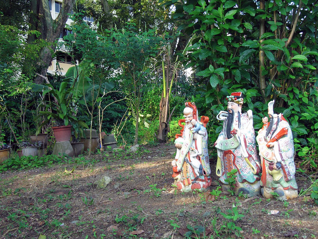
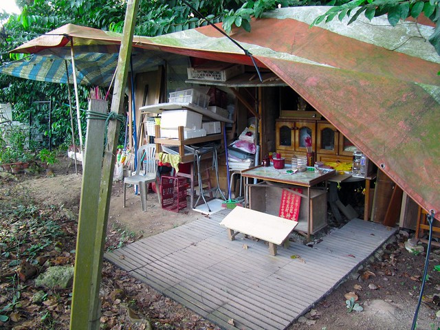
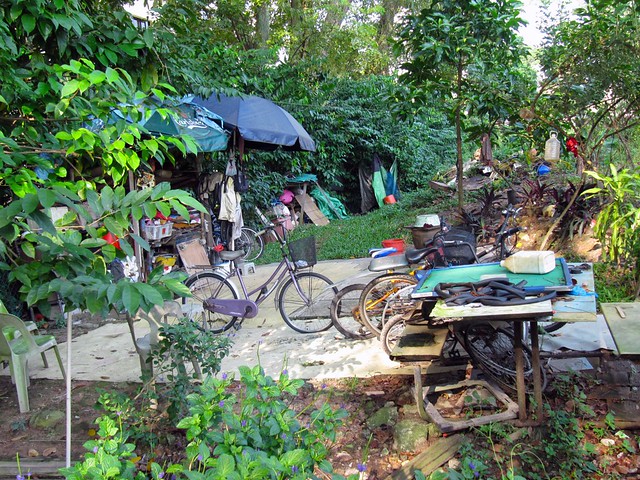
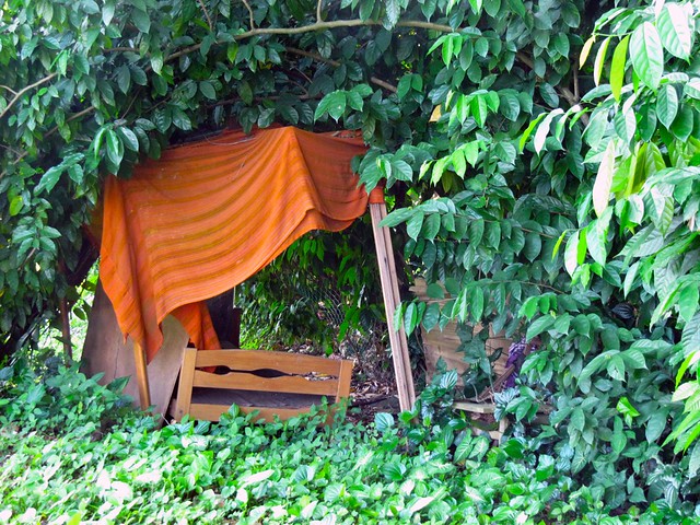
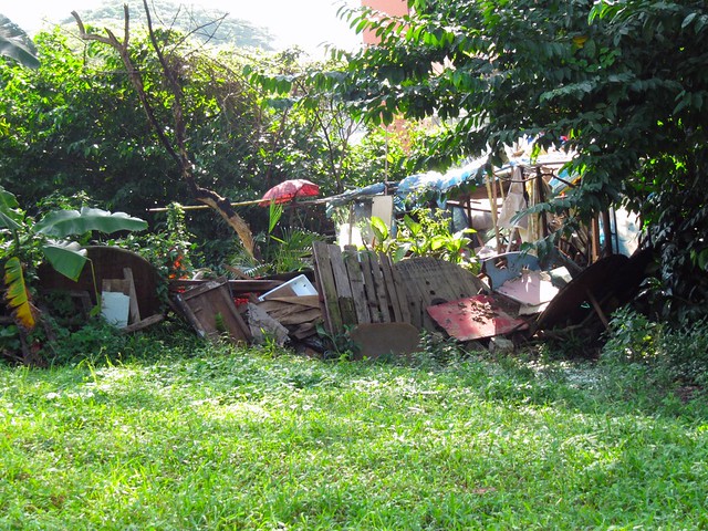
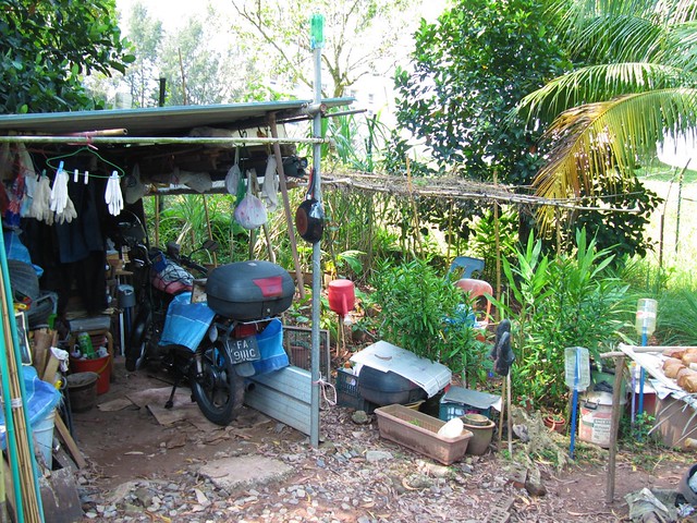
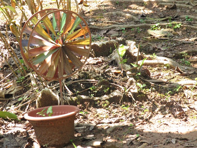
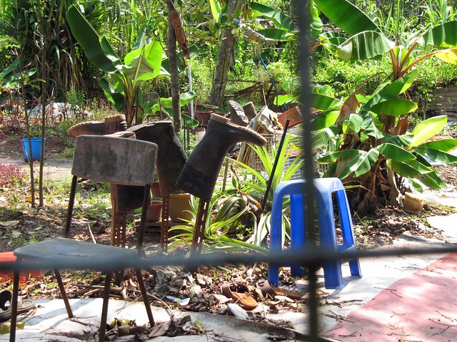
We entered from Penjuru Road and came to this kampung of sort near Teban Gardens Estate. There was not a single person there when we explored the area – only a small plantation area, an altar, many bicycles, and some “Gods” that welcomed us when we entered the area. There was, however, also an actual bed, hidden somewhat in the bushes, perhaps offering a sign that someone actually did live there. Or perhaps, the bed was just there for the “villagers” to take an afternoon nap.
Kampung #2
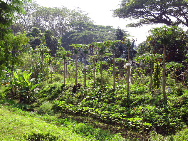
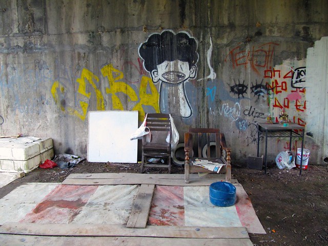
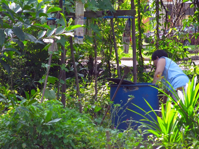
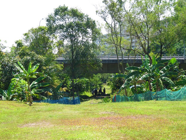
Walking further down along the tracks, we came to the second kampung. Graffiti lined the walls of the area under the bridge next to this second kampung. Or perhaps, this area under the bridge served as part of the kampung. Papaya trees were aplenty. A lady was busy at work in the plantation.
Kampung #3
I’m not quite sure whether this kampung constitutes part of the Kampung Sungai Pandan as it sits nearer to the Commonwealth Avenue West flyover than it does to the Clementi Avenue Six flyover, where the latter is located. There was a film crew there when we visited. Other than that, there was one elderly woman, busy trimming the plants.
Kampung #4
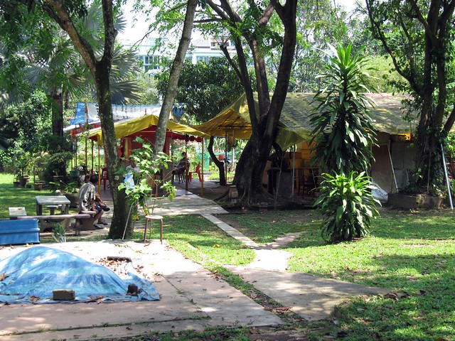
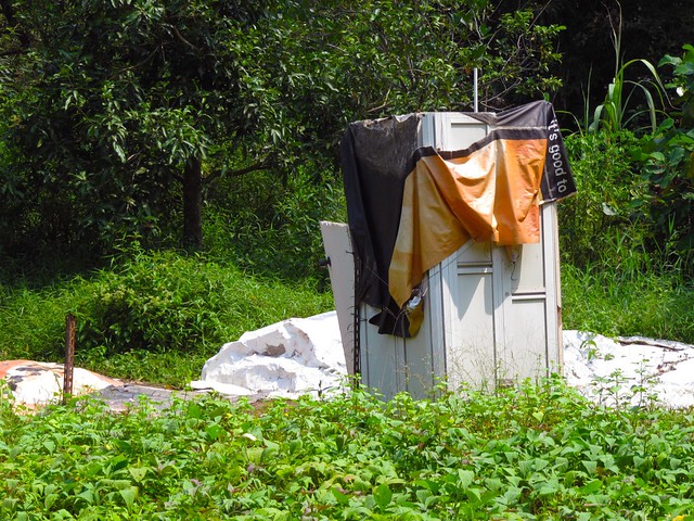
The most developed and most “famous” of the four kampung we saw, Kampung Sungai Pandan was full of activity. Middle-aged and elderly men were sitting around having a morning tea and chat, while some others were sweeping the grounds and taking care of the plants. The area was so well-developed there were actual tiles that lined the ground, a few tentages that were set up, and even an actual toilet built to accommodate the people.
You can read a good article on Kampung Sungai Pandan here.
And that ends my little visit to village life.
If anyone knows the names of the other three kampung, please let me know.
Source: reclaimland.sg
—–
This post is one part of the four part series on the Jurong Line.
You may view the other posts here:
– Jurong Line: A photo guide
– Jurong Line: Is this Goodbye?
– Jurong Line: Digging Up A Bit of My Childhood
Also, to render your support toward The establishment of The Green Corridor, join the “We support The Green Corridor in Singapore” Facebook page.


5 comments
Pat says:
Jan 24, 2012
I wonder why you divide the KTM railway stretch behind Teban Gdns into Kampung #1 & Kampung #2 ? The whole stretch is not an official kampung, & has no names that I know of.
When the abandoned Jurong Line behind Teban Gdns was still under Malaysian/ KTMB administration, the area was much more rustic, more intensely-farmed, & of lower elevation. It was one of those verdant linear farms done up ad-hoc by residents from the adjoining Teban Gdns estate, after the Jurong Line was discontinued during the early 1990s.
Unlike today, the entire stretch between Penjuru Rd (western boundary) & the Teban Tunnel (eastern boundary) was completely covered by small parcels of vegetable, herb & fruit tree plots. Some farmers also kept poultry like chickens & ducks. One of the most prominent veggie-produce that you could buy here was Pandan leaves. An elderly Malay lady planted these on both sides of the then-intact railway track — along the stretch from the shortcut-path/stairs (leading to AYE) until before the railway tunnel below Jurong Town Hall Rd.
And although some farmers built small ramshackle rest-cum-storage shelters here, these were never formal/ permanent residences. (Don’t forget that the farmers’ HDB flats are just a stone’s throw away.) This is one key factor that differentiates such areas from S’pore’s genuine old kampungs (which had lived-in houses & shops).
In the early 2000s, SLA put up lawyer’s letters & ‘No Trespassing’ signages, before bulldozing & burying the entire stretch under 3-4m depth of clay earth, thus creating a new central ditch. (This was where the railway track was shallowly buried, before SLA unearthed it & tore it into pieces in Feb 2011). Subsequently, the land was left barren for several months — until some of the still-alive (plus new-generation) farmers surreptitiously reclaimed the area. To this day, SLA contractors continue to regularly mow down the grassy stretches that have not been re-occupied by farm plots. In addition, all of the wall’s interesting graffiti-art has since been washed over with white paint, after all local railway tracts were reverted to S’pore administration in July 2011.
On the other hand, Teban Gdns estate itself is located on the site of a Malay kampung called Kampung Java/Jawa Teban (sometimes unofficially shortened to **Kampung Teban), which existed until the early 1970s before JTC redeveloped the area. This kampung consisted of some 400 stilt houses located amidst the Pandan Mangrove swamp just off the original meander of Sungei Pandan Besar (ie. the former name for Sungei Pandan river, before it was canalized & straightened). The expunged river-meander is approximately traced out by the boundary of the current Pandan Reservoir.
Some NHB archival photos of Kampung Java Teban: At high tide, during low tide.
(** Note: To be confused with the other Kampung Teban off Tampines Rd. This was a largely-Chinese, cattle-rearing, terrestrial kampung.)
Pat says:
Jan 24, 2012
From post: Kampung #4: The most developed and most “famous” of the four kampung we saw, Kampung Sungai Pandan was full of activity.
For info, Kampung #4 (ie. the farmed plot at Clementi Ave 4/6, beside the **Sungei Ulu Pandan canal — ref: ‘Balik Kampung’ article’s) is NOT the original Kampung Sungei Pandan.
(**To digress, Sungei Ulu Pandan is a totally-artificial inland waterway planned during the 1950s. Construction begun in 1960 & continued until the 1970s. Its main function is to divert excess floodwaters from Bt Timah Canal to the sea via the downstream Sungei Pandan Besar.)
Instead, the real Kampung Sungei Pandan was situated very much further downstream, near the mouth of Sungei Pandan (Besar) & in the vicinity of PUB’s tidal-gates (ie. between Pandan Loop’s factories & Pandan Reservoir).
Also consisting of stilt houses, this Malay kampung used to overlook the old S’pore Yacht Club, which was previously located on the opposite bank of the same river. Here’s a NHB 1966 photo showing Kampung Sungei Pandan in the background, as fringed by the former coconut plantation of the West Coast area.
In fact, after Sungei Pandan (Besar) was dammed by tidal-gates in 1975, Kampung Sungei Pandan was hit by a very bad flood during a predawn Sumatra Squall in Nov 1976, whereby water from the river rose above the height of the stilt houses for the first time in the residents’ living memory.
More info from NLB’s archived media articles:
Locked Tidal Gate is Blamed for Flood (ST – 02 Nov 1976)
PUB: Tidal gates WERE open during the storm (ST – 03 Nov 1976)
deafknee says:
Jan 27, 2012
Thanks Pat for sharing a very comprehensive description of the kampung area along the Jurong Line. I grew up in the 1980s and 1990s and clearly did miss out on a lot on true Kampung life. Did you use to stay along this area hence your knowledge of this area?
As for why I divided the “kampungs” into Kampung #1 and Kampung #2, it was merely because they appeared like separate kampungs of sort when walking along the stretch. I did guess they were probably never official kampungs of sort since the gardens were created by residents of the Teban Garden Estate and thanks for confirming that.
Once again, thanks for sharing!
Favian says:
Jan 1, 2013
The kampungs have been demolished when I went there sometime in the middle of 2012. I heard they’re redeveloping it to be “nicer”. Not sure what the status is now, but the Singapore Nature Society should know a thing or two since they’re the ones who organized the butterfly walk that I attended.
deafknee says:
Jan 15, 2013
Hi Favian, thanks for sharing.
Just out of curiousity, When did you attend this butterfly walk?
I heard the revedeveloped area is rather polished now.